 EarthView Maps
Download Additional Maps
Please click the following links to download additional maps for EarthView. The maps are compressed (ZIP format) to allow shorter download times.
High Resolution Maps
The 10 km resolution maps are freely available to everybody. The 5 km resolution maps are only available for download for registered users who purchased the full version of EarthView. A user name and password for the restricted download area will be sent to you per email when you purchase the product. Ultra high resolution versions of the seasonal and realistic maps are available for customers, who have purchased a cloud data subscription. Please contact us with your subscription ID for your personal download link.
Installation Instructions
To install the maps, please copy the downloaded ZIP files to the EarthView installation directory (the location, where EarthView was installed to, e.g. "C:\Program Files (x86)\EarthView" - you can open this location by clicking on its link in the "About" dialog). Don't change or rename the map files, or they will not work!
When your restart EarthView, the new maps will be processed, which can take a few minutes. After that, they will appear in the list of available maps.
WARNING: The high resolution maps need a lot of space on your hard disk - about 100 MB for each 5 km map and 500 MB for the 3 km maps! The seasonal 5 km map uncompresses to approx. 1,3 GB and the seasonal 2 km map needs 8,2 GB! Please make sure that you have enough free hard disk space before downloading and installing these maps!
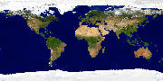
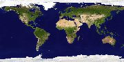
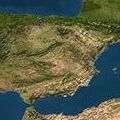
Map 1: Seasonal
The "Seasonal" map is generated from 12 satellite pictures of the earth, one for each month of the year. It is very realistic and shows the seasonal changes of the vegetation, snow cover and even the variation of the ocean ice!
Overview |
10 km |
5 km |
2 km |
 |
 |
 |
 |
|
(included in demo) |
Download (44 MB) |
(see below) |
The download of the 2 km version of the seasonal map is about 224 MB. It is only available to customers who have purchased a cloud data subscription. Please contact us with your subscription ID for your personal download link. WARNING: the 2 km seasonal map expands to about 8,5 GB on you hard disk - please make sure to have enough free hard disk space before downloading and installing this map!
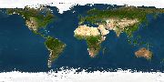
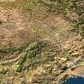
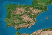
Map 2: Photographic
The photographic map is generated from satellite photos of the earth. It is very realistic, just a bit optically enhanced.
Overview |
10 km |
5 km |
 |
 |
 |
|
Download (1.2 MB) |
Download (5,2 MB) |
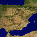
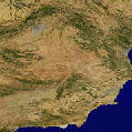
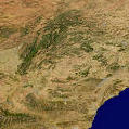
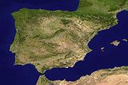
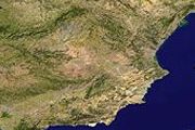
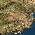
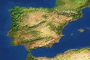
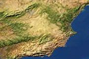
Map 3: Realistic
This map is also generated from satellite photos of the earth. It is very realistic, elevations are shaded, colors are enhanced.
Overview |
10 km |
5 km |
3 km |
 |
 |
 |
 |
|
Download (1.3 MB) |
Download (7.0 MB) |
(see below) |
The download of the 3 km version of the realistic map is about 22 MB. It is only available to customers who have purchased a cloud data subscription. Please contact us with your subscription ID for your personal download link. WARNING: the 3 km realistic map expands to about 500 MB on you hard disk - please make sure to have enough free hard disk space before downloading and installing this map!
Map 4: Artistic
This map is generated from real data and drawings of the earth surface. Not as realistic as the satellite maps, but very beautiful and still topographically correct.
Overview |
10 km |
5 km |
 |
 |
 |
|
Download (1.5 MB) |
Download (5.9 MB) |
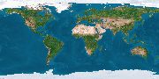
Map 5: Scientific
This is an analytical map, which shows the distribution of land, sea and green areas.
Overview |
10 km |
 |
 |
|
Download (1.3 MB) |